The advancement of mankind has for long been a threat to wildlife. The latest threats have come to the nesting birds on agricultural grounds which are being displaced from their habitats owing to agricultural activities.
Physical inspections and thermal imaging on the ground have been practiced for years but not without its fair share of problems such as; dense vegetation, objects along the path of inspection.
What has been proposed?
| Integration of System |
Researchers have devised an arrangement of drones equipped with thermal imaging sensors that will capture multiple heat-sensitive images which will be fed into an Artificial Intelligence-powered software to accurately map nests and inform co-ordinates for the nest which can be relocated before agricultural activities take place.
“The system works best under cloudy and cold conditions surveying uneven grounds.”
The system is currently being tested in Southern Finland with the test subject being a Northern lapwing bird.
How was the study conducted?
 |
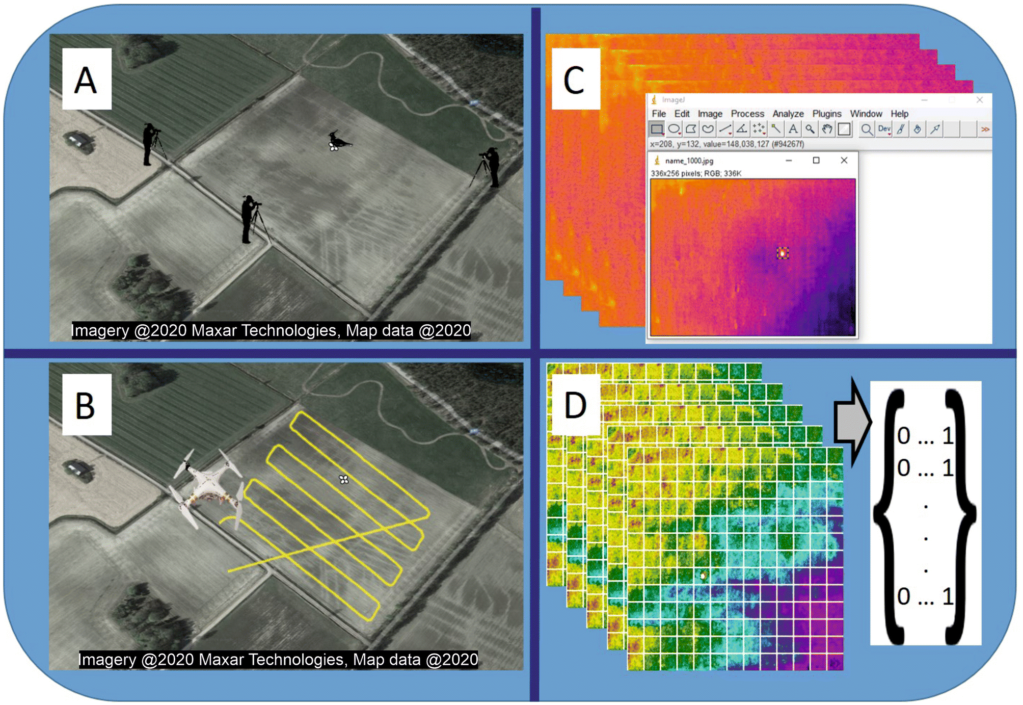
| Steps Under the Study |
An appropriate field was chosen for the study (fig.A)
The drone is flown over a pre-programmed route(fig.B)
Thermal images are prepared by extracting co-ordinates of the boxes drawn around the nest.(fig.C)
A neural network deep learning algorithm is applied to classify whether there is the presence of a nest. (fig.D)
Our Take on This
The use of drones in agriculture is ever-growing finding it’s application in precision agriculture, to monitor the real-time spread of disease amongst crops and maximizing efficiency. It takes off physical labor from the shoulders of humans while increasing the accuracy of detection. We believe integrating it into traditional agriculture would be a groundbreaking move when the world strives to move an inch closer to saving nature.
It would be worth watching how it behaves under different climatic conditions, habitat, and species.
Bibliography:
Comments
Post a Comment